The PUPCYCLE Log is also available for download as two pdfs:
Friday, May 24, 2019 – Newport, Oregon
Heading to the California Upwelling Zone (CUZ that’s where the plankton are!)
The California Current flows southward along the coast of California, bringing cold water from the Polar region toward the Equatorial region farther south. This current is also referred to as an
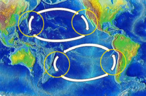
Eastern Boundary current. The Pacific Ocean has two main Eastern Boundary currents (shown in Figure 2): the California Current along the coasts of California and Baja, Mexico and the Humboldt Current flowing northward along the borders of Peru and Chili. Eastern Boundary currents flow shallower, broader, and slower than the Western Boundary Currents, like the Kuroshio (near Japan) and the Gulf Stream in the Atlantic, which are deeper, narrower, and faster flowing currents.
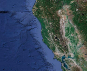
The other characteristic associated with Eastern Boundary currents is the appearance of upwelling. Applying what we know about Eastern Boundary currents with a closer look at the bathymetry along the California coast will provide a better understanding of upwelling processes. Bathymetry refers to the “lay of the land” or the shape of the seafloor found beneath Earth’s oceans. Figure 3 reveals areas of narrow and wide continental shelf where the scientists will be focusing their research. This area is referred to as the California Upwelling Zone.
During the next two weeks, the scientists onboard the Research Vessel Oceanus will be conducting experiments within this region of the Pacific Ocean. Follow our 2-week expedition as I introduce you to some of the researchers, the technology, and the amazing microscopic organisms that contribute so much of their energy to reducing carbon dioxide from our atmosphere while providing oxygen for the survival of all living things on planet Earth.
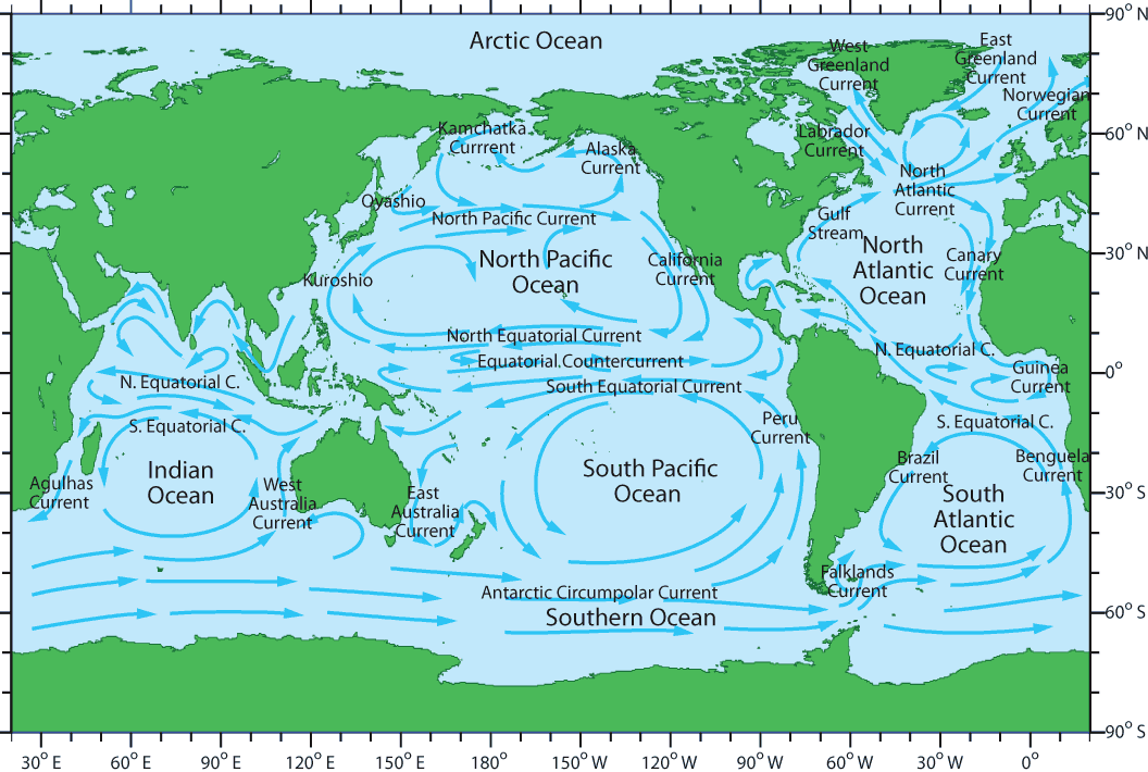
Today’s Certificate Challenge*: Look at the World Ocean Currents map (Figure 1) and see if you can identify the Eastern Boundary currents for the Atlantic Ocean.
*A Certificate Challenge will be provided each day with my blog. Collect answers to each challenge and enter them in the PUPCYCLE QUIZ on the final day of our voyage for your PUPCYCLE Certificate.